Thursday, June 6, 2013

Winter 2013 in Texas

This was our third year of wintering on South Padre Island (SPI) and elsewhere in the great state of Texas.  In 2011, we spent 2 weeks at the Royale Beach and Tennis Club Resort.  This year (2013), six weeks was the length of our stay there. 


Most of our days were spent walking the beautiful beach and then spending the afternoon socializing with other winter Texans (that’s northerners from USA and Canada who are successfully escaping the cold and snow) in the swimming pools and/or hot pools.  Nearly all of them are older than us (70’s and 80’s), but they are still very active and always interesting to visit with.


Unlike prior years, we saw many jellyfish and the colorful Portuguese Man-of-War during our beach walks.  Some days there were thousands of them being washed up on the beach, where they dry out and die.  We were careful not to handle them, as their tentacles can give an uncomfortable sting.


 My very good friend and college roommate, Bill Lucas, spent a week with us.  Unfortunately, his visit coincided with our coolest week during our 9-week stay in Texas.  We all did the 3 mile causeway walk/run (we walk) on the 2nd Saturday of January. 


 Bill likes to geocache and introduced us to the practice.  According to Wikipedia “Geocaching is an outdoor recreational activity, in which participants employ a Global Positioning System (GPS) receiver or a mobile device or other navigational techniques to hide and seek containers, called "geocaches" or "caches".  Our GPS used for driving directions enabled us to get a taste of what this activity is.  There were several geocaches on South Padre Island, we found the one we sought.  If you do a search on the Internet, you can find geocaches in your area I’m certain.

One day, we went fishing on the lagoon accompanied by Bev and Gordon Muller, people who we met in 2011 on South Padre who also live in Kearney.  Gordon is in his early 80’s and goes surf fishing many mornings.  They provided an introduction to many of the other people at the resort, as this was their 22nd year coming to SPI and the Royale.  Our fishing wasn’t very successful, as between the 4 of us, we caught enough for a small snack for Elaine & I.


I know that the photo doesn’t show me with a fishing pole, but rest assured, I did have one and even baited it myself.   That’s Gordon & Bev in the photo with me.

While on the water, we were entertained by a pod of dolphins.  Dolphins are quite common here and we would usually see a few on our daily beach walks.

 
Elaine and I were tempted to go into business on SPI after finding the perfect business site.  We chose to turn down this opportunity.


Nearby to SPI, is Palmetto Ranch, the site of the last land battle of the U.S. Civil War.  It was fought on May 12 and 13, 1865 more than a month after General Robert E Lee surrendered his army at Appomattox Courthouse.


 The last Confederate surrender was not until November, 1865 when the Confederate warship Shenandoah struck its colors in Liverpool, England.  Back to the battle.  Here’s some background.  Since Texas borders Mexico, a great deal of trade was conducted across the border during the war in order to avoid the coastal blockade stretching from Virginia to Texas.  Cotton raisers would transport their bales to Mexico, where the bales would be sent to the Mexican coast and loaded onto ships bound for Europe.  Weapons, ammunition and other supplies were similarly sent to the Confederacy by this route since the naval blockade did not affect Mexico.  Mexico, at this time, was occupied by the French, who in 1864 took the reins of government as a result of Mexican nonpayment of its debts to France.   

Colonel Theodore Barrett, local commander of Union forces had not yet been in battle and probably wished to pad his resume for the post-war era.  He ordered his 1,700 or so troops to route a force of 300 Confederates and seize whatever cotton they could get their hands on.  Things did not go well for the Colonel – his forces were routed and he retreated suffering 4 fatalities and many more wounded, while the Confederates had no fatalities.  As the Colonel was retreating, the southern soldiers crossed the Mexican border and the war was over in Texas.  An interesting side note is that this battle was the only battle where foreign troops took to the field of battle in support of the South.  A unit of French Foreign Legion artillery contributed to the route of Barrett.  There is little to see at the battlefield other than the historical plaque and billboard pictured, however, this was on my list of must see places in the USA.

Another day was spent at the Sabal Palms Sanctuary on the Rio Grande River.  The sanctuary preserves a remnant of the Sabal Palm forest that once lined the Rio Grande River.  Nearly all of it was cut down and made into cropland.  Fortunately, this small section remains.


The sanctuary is within 20 miles of the mouth of the mighty Rio Grande, which forms the border between Texas and Mexico.


 Yep, that's the Rio Grande.   A good  stones throw across.  Hardly more than 20 yards wide.  Most of the water of this once mighty river either evaporates in the arid climate along its course or is used for irrigation. 

The US/Mexican border has a fence along the river to deter would-be illegals (undocumented persons for those who like to change the meaning of terms). 


 The fence is actually a couple of miles into the USA, as per international treaty with Mexico that any obstruction along the river must be above the flood plain.  The road to Sabal Palms goes though the path of the fence.  There must be surveillance cameras, as no border patrol was in evidence.

The sanctuary has several trails through the forest and makes for a pleasant morning stroll.  My advice is bring plenty of mosquito treatment if the temps are above 60 degrees, as they really will swarm you.  Fortunately, we were there in the cool of the morning.  Spray is available at no charge at the visitor center.


 Within an hour of SPI is the Laguna Atascosa National Wildlife Refuge.  For those of you with Golden Age passes, bring it with you to avoid the nominal ($5 per vehicle) entrance fee.

 
The refuge is the home of the few ocelots that remain in the wild in the USA.  The refuge closes at 5 PM and ocelots are nocturnal, so don’t expect to see one.  It is also reputed to occasionally host the Gulf Coast jagarundi (another rare wild cat) - also nocturnal.  However there are good views of the Laguna Madre (the body of water separating Padre Island from the Texas mainland) and plenty of birdlife to view.  You can see the skyline of SPI across the lagoon.


Among the birds we saw there were the green jay, the curlew, chachalaca (that’s a bird not a dance), a scarlet tanager and various water birds.


 Also saw one of Texas’s largest snakes, the Texas indigo snake.  Several feet long – I kept my distance.  It is not venomous.


After 6 relaxing weeks on SPI, we left on our way to the Texas Hill Country.  On the way, we made a detour to Corpus Christi, Texas where we spent the better part of the day on the WW II aircraft carrier USS Lexington CV-16.


 There was an earlier Lexington, the CV-2, which was lost in the Battle of the Coral Sea in May of 1942.  The CV-16 was under construction when the loss of the Lexington occurred.  The CV-16 was to be named the USS Cabot until the shipyard workers asked that the ship be named Lexington in honor of the recently lost vessel, and so it was.  The picture details the various engagements that the Lex participated in and the destruction it and its aircraft rained on the foe.  Quite a formidable adversary.


There is nearly complete access to the many decks of the ship.   Elaine takes the helm in this shot.  Fortunately, she was going forward and not in reverse as her aircraft carrier backing skills need improvement.


On the flight deck, a portion of the original wooden surface has been preserved, while the rest of the deck has been paved to make the deck smoother.


 The various types of aircraft that flew off the carrier are displayed on the flight deck and the hangar deck.  Some are from the WW II era and others from the more modern era of jet aircraft. 


You can get the idea of how massive the hangar deck is in the background of this photo (the shops and displays are for today’s tourists.

  
Wherever there was open space not used for aircraft, protective guns were placed.


Below the hangar deck is where the crew lived when off duty.   The sailors were not free to wander about the hangar or flight deck, after all it was war and these were dangerous places to be if you weren’t supposed to be there.  The lower decks included the crew quarters and all the things needed to support the crew.


Such as a gleaming stainless steel cafeteria (complete with plastic replica mess stewards and food),

a dental suite (there were 5 of them, as I recall),

 
postal facility,


sick bay,
  and chapel.


To keep the self guided tour interesting, several exhibits are scattered about the lower decks:

Mines and torpedoes and

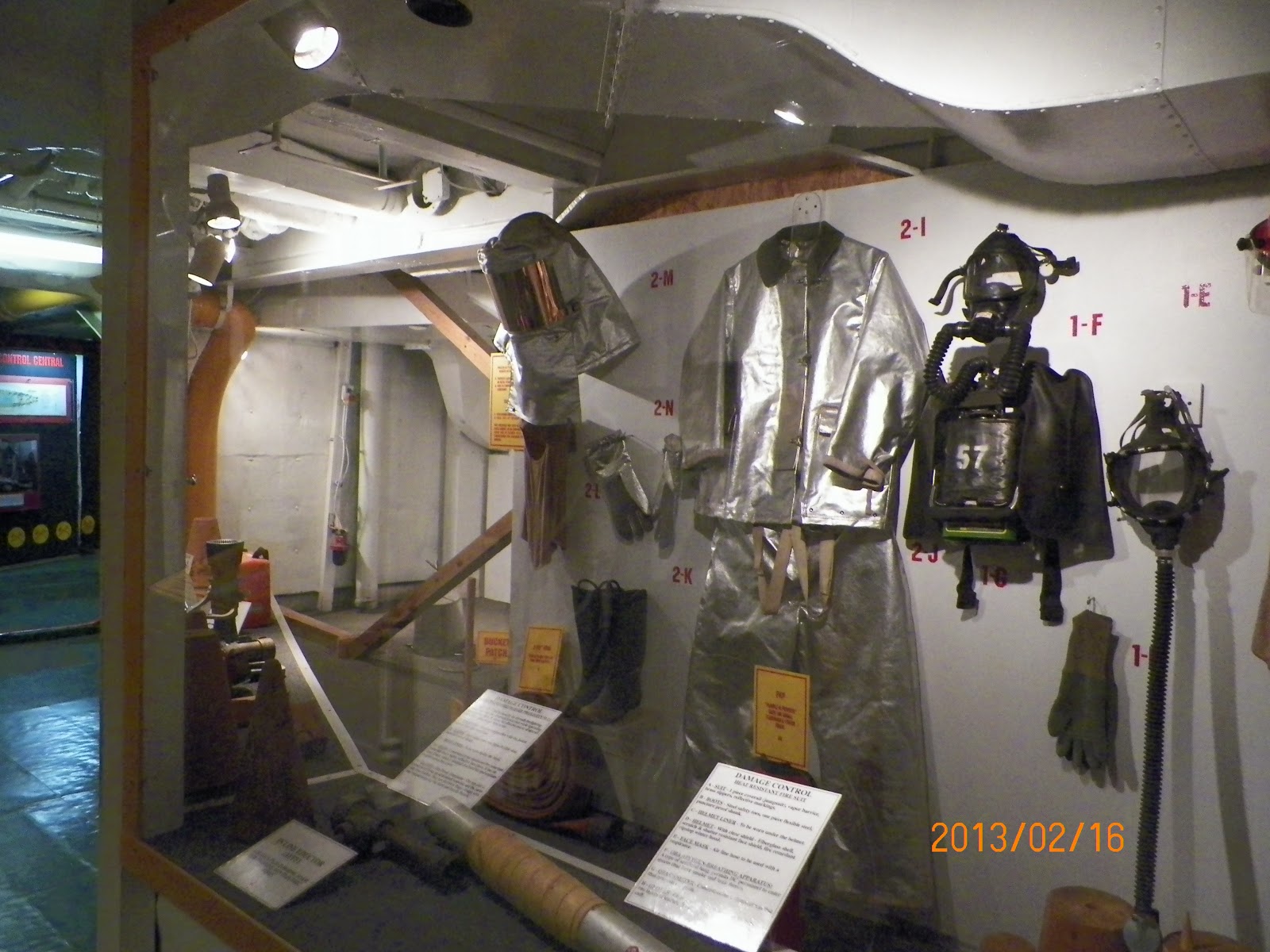
firefighting on board.
 

 As you descend deeper in to innards of the ship, you come to the engine rooms – 4 massive engines, turbines and heaps of gauges and dials to monitor.


It was time to anchors aweigh as we left the ship and proceeded to our home for the next two weeks in the Texas Hill country at Canyon Lake where we stayed last February (see June 2012 slutigram).  One item that we did not have in 2013 but were graced with in 2013 was a visit from Anne.


 Last year, we toured the Hill Country and went to Austin on several occasions.  In 2013, we toured other parts of the Hill Country and spent several days in San Antonio and only one evening in Austin at opur favorite dueling piano bar.  With Anne, we went to the fabulous San Antonio Botanic Gardens, where the plants were in full flower.  Take a short pictorial tour with me:


Time for lunch:

Oops, sorry, the food was so good that we never thought to take a photo.  Well, here is what the plates, glasses and cutlery look like.
Back to the Gardens:


My favorite fruit, loquat.  Too bad I couldn’t reach the tasty morsels for an after lunch snack.


When you come to San Antonio, make sure you see these gardens, they are a joy.  I have many more photos, but you get the picture (pun).

We spent the evening with Anne walking the River Walk and downtown areas.  The city predates independent Texas by over 100 years.


 Throughout downtown, statues of famous Texas appear.  Austin Texas is named after early pioneer Moses Austin appropriately standing before today’s city hall.


Enjoyed a good German dinner and beer of course.

The San Fernando Cathedral houses the remains of many of those who died defending the Alamo in 1836.


The original 1749 Spanish Government house can be seen.  We were there after closing hours, so did not tour the inside.


Following this, we strolled the Riverwalk until darkness and sore feet told us it was time to go home. Incidentally, the Riverwalk is being extended for several more miles in the near future.


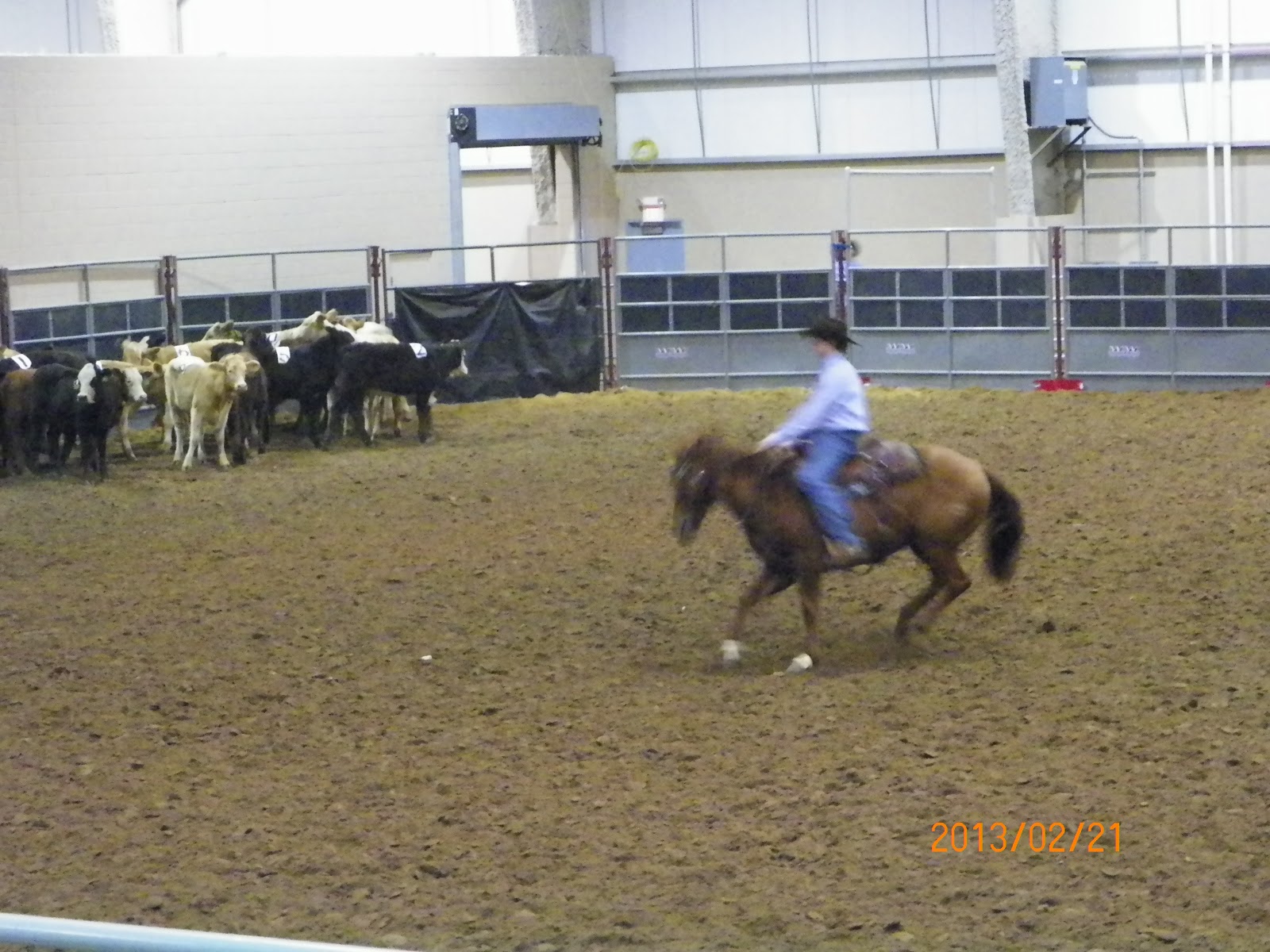
 Anne had to return to her home after a wonderful few days with us.  The San Antonio Rodeo was taking place.  This merited a visit.  The rodeo is similar to a State Fair, as there are plenty of other things going on besides rodeo events. 


Got to see a live ocelot (who was sleeping of course),


 An alligator (who was not sleeping)


 Carnival rides and overpriced sugary fatty foods were in abundance.  Say, that doesn’t look too bad.


Went to the pig races, complete with audience support.


We spent a full day at the rodeo and returned home all tired out.

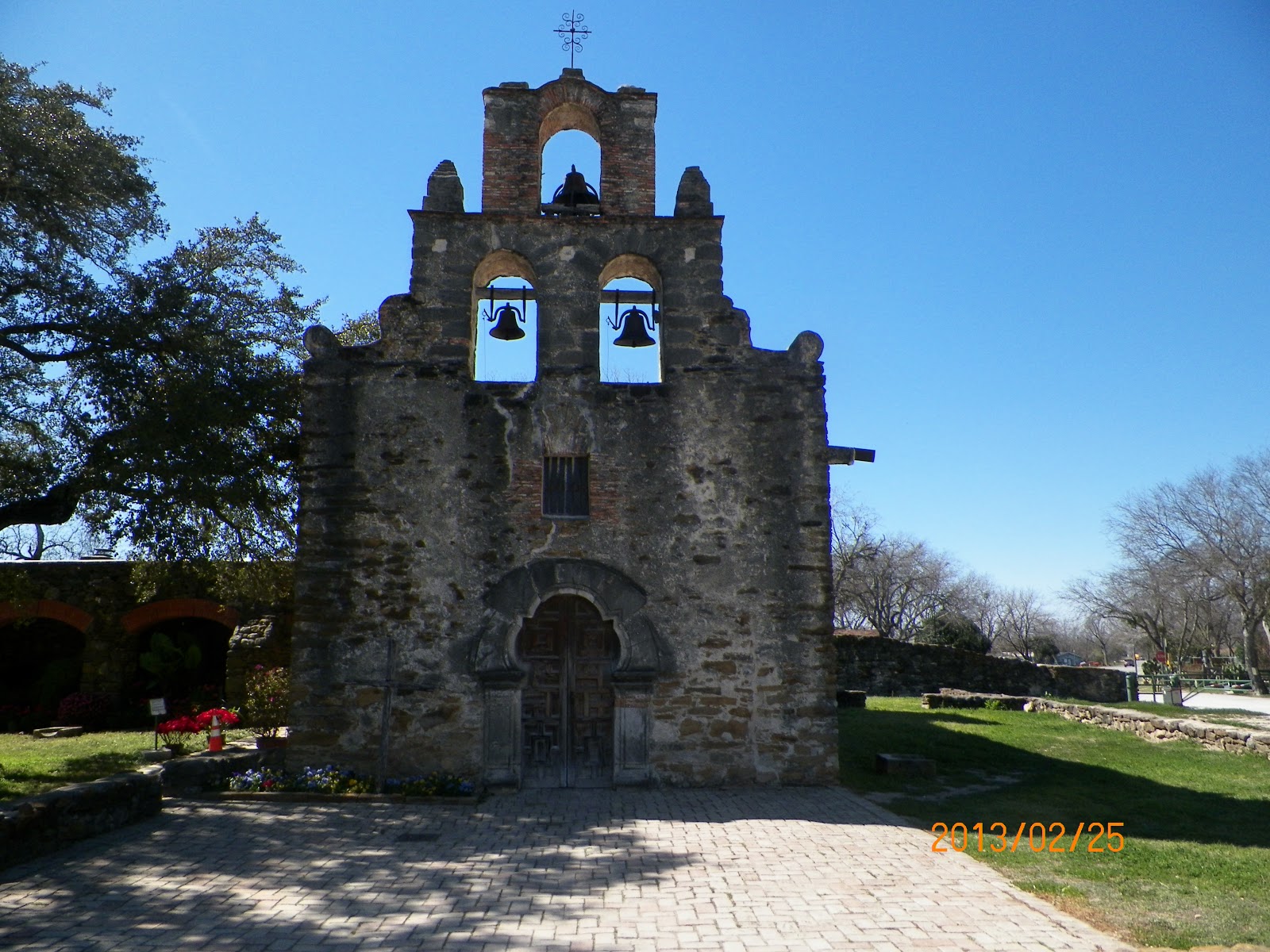
San Antonio had several mission churches.  Many of them still are there and are open to the public as part of the US National Park system.   Can’t recall paying any admission charge, so they must be free.  They all date from the 1700s are in various states of restoration.  Most of them have attached displays or museums/gift shops.  A must see in this city.  The 5 missions are:

Mission Concepcion


 Mission Espada


 Mission San Jose.  You can see in the one photo that the churches were painted in various colorful patterns – age and weather has worn most of them back to their stone construction.


 Mission San Juan


Besides the mission church itself, each of these missions had a stone wall enclosing several acres which was used for livestock.  Along the walls, there were small rooms that provided homes for the Christian Indians living there.  Photo shows the layout at San Juan.


The 5 mission churches trace the path of the San Antonio River (a water source was critical) from the suburbs to downtown.  Each are within a couple of miles of the next mission. During the Texas war of independence, skirmishes were fought at most of these missions.  Most famous of all was the battle of the Alamo in 1836.  As we had already visited the Alamo on a previous trip, we skipped that in order to spend more time at these other fascinating sites.
Spent another morning at the Natural Bridge Caverns near New Braunfels.  Of all the caverns I have been in (maybe 10 or more) this was by far the warmest.  Usually you need to wear a jacket, as the temps remain around 50-55 degrees Fahrenheit year round.  The caverns were in the 70s and very, very humid.  Interesting formations abounded.  Our guide was in his first week as a guide – he did very well.  They must have a very good training staff.  Incidentally, the natural bridge is above ground.


This was the first time that they did not turn off the lighting to give you an idea of what total darkness is like – every other cavern that I have toured has momentarily turned off the lights.

On the advice of friends, we climbed the hill at Enchanted Rock State Park near Fredericksburg.  The rock is a massive granite monolith, similar to Stone Mountain near Atlanta Georgia (see June 2007 slutigram).  Except there is no way up other than walking.


Puff, pant, pant


 Once at the top, you are rewarded with some panoramic views of the Hill Country.


We were befriended by a couple who were from Nepal (now living in Austin).  They were a lot of fun to talk with and had great senses of humor.  They even invited us to have lunch with them; however, since all they had with them was a big bag of Doritos, we gracefully declined.  Obviously, they have become Americans with a diet like that.


After all of this and more, we returned to Nebraska in early March hoping that winter was over.  No such luck, our last snowfall was May 2nd.  We may stay longer next winter.

Sunday, March 3, 2013

Boston & Cape Cod May 2012


 This was our first visit to Anne in Boston, where she moved in 2011. 

We flew in to Boston and stayed in Revere, a close-in suburb of Boston itself.  The next morning, Anne picked us up and we drove to Cape Cod, where we spent a week with Anne.  On the way, we stopped in Plymouth, home of the famous Plymouth Rock, the traditional landing site of the Pilgrims in 1620.

The first reference to the rock occurred 121 (1741) years after the landing.   In 1774, the rock was split in half and the top half moved to the town’s meeting hall.  The bottom was left at the wharf.  In 1859, the columned monument was built and in 1880 the top half was moved back and rejoined to the bottom.  It was then that the year 1620 was chiseled into the rock.  Before 1880, several pieces of the rock were chipped off by souvenir hunters.  It is estimated that 2/3rds of the Rock’s top half were lost this way.  Of course, this important symbol is protected from further desecration today.  Did the Pilgrims land and take their first step onto the rock?  Probably not, but it does make a good story.


A replica of their ship, the Mayflower, bobs in the harbor.  The ship carried 102 passengers.  From the size of the replica, it must have been a very crowded passage to America.


After enjoying a delicious seafood lunch in Plymouth, we proceeded to the town of Hyannis on Cape Cod, staying at Cape Winds Resort.   The week with Anne was so pleasurable, as we explored the sites and had the opportunity to visit all week.

 
Provincetown is sited at the very tip of Cape Cod.  The town has been known for its artists colony and alternative lifestyle for at least a century.  The first steps of the Pilgrims in America were actually at Provincetown, but they decided that its location was not suitable for their settlement.  A stone monument marks the place where it is believed that they made landfall.  Thus, they crossed Cape Cod Bay and made that Rock at Plymouth the place we recall as being their first landing place.  They sure didn’t teach me this in my high school history.

 
Many of the homes are old and quite attractive.


 The sidewalks were packed with tourists (us included) enjoying the views of the homes and foliage.


Hiking the beach at Cape Cod National Seashore is a popular pastime.  The national seashore encompasses nearly all of the eastern part of the Cape.  The beaches are clean, sandy and go on for miles and miles.  Not surprisingly, President Kennedy created this park in 1961.

 
The Cape Cod Potato Chip Company was started in 1980 and offers a self-guided tour of the facility.  Their specialty is kettle cooked chips and they offer free samples in their gift shop.  A hour or so spent their was educational.  It is quite small, making only 350,000 bags a day.

 
We also explored Hyannisport, the well-remmbered summer home of the Kennedy families.  WE attended their church, spent time in the harbor, buit did not get to their compound, which is not accessible to the commoners like us.

Cape Cod Maritime Museum in Hyannisport holds artifacts from the “Sparrow  Hawk”, a pinnacle that was wrecked off of Cape Cod in 1626.  It is the earliest of colonial era wrecks.  A good portion of the hull has been salvaged and preserved.  The Sparrow Hawk had a full complement of colonists headed for Virginia.  Navigation was a hit or miss proposition in those days, with storms and winds potentially driving a ship hundreds of miles off course – which was the case for the Sparrow Hawk.  All survived the wreck and friendly Indians led a few of the survivors to Plymouth Colony, whereupon their governor sent out a ship to rescue them.  The ship was soon engulfed by the sands and mud of the Cape and laid there until another great storm uncovered her in 1863.


In 1914, Cape Cod Canal was completed.  Thus, the Cape is now Massachusetts’ largest island, although most people would not think of the Cape as an island.  The state’s largest natural island is Martha’s Vineyard island.  A large ferry connects the island to Wood’s Hole on the Cape. 


Once on the island, one can easily get around the island by bus – one day pass is available where you buy the ferry tickets on the Cape.  It was a warm sunny day and we enjoyed exploring a couple of the island’s main settlements.  The shores of New England are known for their treacherous, rocky shores and Martha’s Vineyard is no exception.  To make water travel safer, numerous lighthouses dot the shores.


Many of the homes testify to the wealth of many of the homeowners.


The island you see in the distance is Chappaquidick Island, it is connected to Martha’s Vineyard by a bridge/causeway which became infamous on July 18, 1969 when then Senator Ted Kennedy drove off the bridge resultinh in the death of his passenger, Mary Jo Kopechne, thus ending his presidential prospects once and for all.


I had to chuckle at this advertisement on a sign on the island.  Wish we could have made it to see the “Electric Highway Experience”  but I had a full calendar on June 31st.  Actually, I could not find the 31st of June, as it does not exist.


A highlight of our time on the Cape was the day we spent with an high school classmate of mine, Mary Shooshan.  Mary picked us up early in the morning and drove us to the Heritage Museum and Gardens in Sandwich (on the Cape).    It includes museums of art, American history, and automobiles, as well as extensive gardens and grounds featuring a superb collection of Dexter rhododendrons (Mr. Dexter owned the land upon which the attraction is located) and azaleas.  We had hit the jackpot, as the flowers were in full bloom throughout its 67 acres of forested grounds.


An exhibit of classic cars can be visited.


A very educational museum of the works of the famous illustrator, Norman Rockwell, is on the grounds.  No pictures allowed of this for some reason.

 Another exhibit houses early New England treasures and a wooden carousel, that still runs.


Thanks Mary for the wonderful day.

Our week on the Cape ended and we returned to Boston for a few days.  One day we went to the JFK Presidential Library and Museum ( previous slutigrams document our visits to the Presidential museums of Lyndon Johnson, George H. W. Bush, Harry Truman, Dwight Eisenhower, Abraham Lincoln and Herbert Hoover).  The museum documents the public life of JFK, but little new was learned about the private life of him and his family.


Anne conducted us on a walking tour of the downtown parks of Boston, to include the Commons.  There is so much history on display in the monuments and buildings.


One statue caught my eye, that of Edward Everett (1794-1865), the famous orator.  It was he who was asked to make the main speech at the dedication of the Gettysburg Battlefield Cemetery in 1863.  He spoke for over 2 hours.  President Lincoln spoke for 2 minutes – his Gettysburg address.  Sometimes less is better.


By happy coincidence, our nephew Sven was graduating from Boston University while we were in town.  It was a good opportunity to see my brother James, his wife Gillian and their son Sven. 


 To end our trip, we spent 2 days in Connecticut visiting my brothers David and Paul and my cousin Patty Laforte. 

As Anne lives in Boston and likes it very much, I’m sure a return trip will take place.